fbpx

Darwin to Apra Expedition (Silver Explorer)

Darwin to Apra Expedition (Silver Explorer)

APZSS
Call for Price

Description

They may be hard to get to, but the lesser-known islands of Indonesia and Micronesia are well worth it. Experience cultures and traditions that make up the beating heart of the region – get off the beaten track with a Zodiac trip to Agats and (hopefully) meet the reclusive Asmat tribe, learn the near-forgotten art of traditional sailing in Yap and if luck is on our side, swim with harmless whale sharks in Papua New Guinea.

Trip Name
Darwin to Apra Expedition (Silver Explorer)
Days
20
Overview
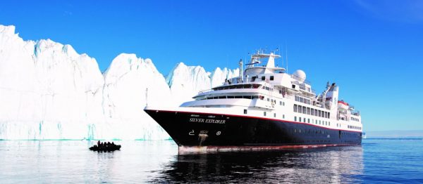
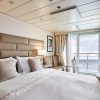
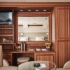
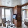
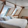
Vessel Type: Luxury Expedition Length: 108 metres Passenger Capacity: 144 Built / refurbished: 1989 / 2008 / 2018 Silversea’s purpose-built luxury Silver Explorer expedition cruise ship has been designed specifically for navigating waters in some of the world’s most remote destinations, including both of earth’s polar regions. A strengthened hull with a Lloyd’s Register ice-class notation (1A) for passenger vessels enables the Silver Explorer Expedition Cruise Ship to safely push through ice floes with ease. A fleet of 12 Zodiac boats allows Silversea Expedition guests to visit even the most off-the-beaten path locations and an expert Expedition Team provides insight and understanding to each unforgettable Silver Explorer luxury cruise adventure.

Itinerary


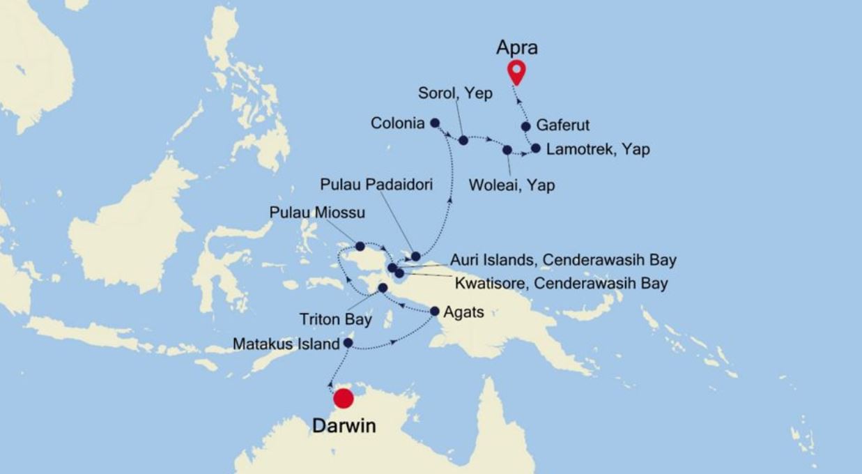
Day 1 - Day 1 Darwin
"Australia's capital of the north is a uniquely tropical city, and a historically isolated outpost of this vast, diverse country. Reaching up towards the equator, a full 2,000 miles from Sydney and Melbourne, the city was named in honour of Charles Darwin by the British settlers who established a frontier outpost here. With a unique history, beautiful islands nearby, and a palette of sizzling Pacific flavours, colourful Darwin is an enchanting and exotic Australian destination. Crocodiles patrol the jungled waterways and tropical rainforests around Australia's gateway to the Top End. Explore via airboat to look down on the veiny waterways of the mist-laced Kakadu National Park. The sounds of chattering birdlife and the gentle splash of fountains and waterfalls will fill your ears in George Brown Darwin Botanic Gardens. Soak it all in, before kicking back and relaxing with a picnic and a crackling barbecue. The sunshine and famous tropical pink sunsets mean many visitors naturally gravitate to the city's soft sands to relax at spots like pretty Mindil Beach, as evening approaches. The adjoining market is filled with souvenirs and crafts stands and is the perfect great place to enjoy some fiery Asian flavours. Stroll the stalls, grab some food, and crack open an ice-frosted beer as the sunset show begins. It may be remote, but Darwin found itself on the front line during the Pacific War, as the Japanese air force unloaded their bombs onto the city in 1942. This relaxed unassuming city has a deeply resilient backbone, however, and you can explore the museums to learn more of the war's impact on Darwin, as well as the devastating effects of one of Australia's worst natural disasters, Cyclone Tracy in 1973."
Day 2 - Day 2 At Sea
a:0:{}
Day 3 - Day 3 Matakus Island
Matakus is a small island and part of the Tanimbar archipelago. Matakus is just over two miles in length and less than a mile across. Despite its small size, its proximity to the regional capital city of Saumlaki just to the north ensures that the island is inhabited. The island is surrounded by fine, white-sand beaches and is a marine paradise, with fields of staghorn coral and schools of cardinalfish visible in its crystal clear waters.
Day 4 - Day 4 At Sea
a:0:{}
Day 5 - Days 5 - 6 Agats (Asmat)
The Asmat is a region of nearly inaccessible forested wetland that has long sheltered Asmat tribes from outsiders. The village of Agats is the capital of the Asmat region. The homes, longhouses, shops, schools and religious centers of Agats are all located along elevated wooden and concrete boardwalks in the heart of a dense mangrove thicket. The Asmat Museum is a must-see. Here it is possible to dote over exceptional examples of the Asmat’s renowned and vibrant woodcarving traditions. Elaborate displays of ancestor poles, drums, body masks, shields, daggers, and skulls, are reminders that headhunting and cannibalism were practiced here until the 1970s.
Day 6 - Day 7 Triton Bay
In 2008, the Kaimana Regency declared a 6000 square kilometer (over 2,300 square mile) Marine Protected Area around the waters of Triton Bay. Conservation International maintains an office in Kaimana and a field station out in Triton Bay where visiting scientists can do their work studying the staggering marine biodiversity of the reserve. It is truly second to none, and the area offers everything from the tiniest pygmy seahorses, to large and graceful whale sharks. Triton Bay is known for its beautiful soft coral gardens as well as nesting green turtles, and a population of coastal Bryde’s whales.
Day 7 - Day 8 At Sea
a:0:{}
Day 8 - Day 9 Pulau Miossu
Almost totally covered in coconut palm trees, Pulau Miossu is the western and smaller of the two Su Islands. Located at the eastern entrance of the Dampier Strait and within sight of West Papua’s north coast, the Su Islands were used for a short time by Allied Forces at the end of WW II to have P-38 fighter planes stationed there. Today, little remains from those days and even the former airfield is covered by vegetation. Pulau Miossu has just a few houses and is occasionally visited to harvest coconut and to enjoy the white sandy beaches and the rich underwater world.
Day 9 - Day 10 Auri Islands (Cendrawashi Bay)
The Auri Islands lie within the Cenderawasih Bay (Indonesian for Bird of Paradise Bay), is a large bay on the northern coast of West Papua, New Guinea, Indonesia. When this area was part of the Dutch East Indies the bay was called Geelvink Bay, after a Dutch ship. Cenderawasih Bay is dotted with hundreds of small islands and atoll’s that are home to some of the most pristine hard coral reefs in Indonesia with one of the highest concentrations of endemic fishes in the Pacific Ocean. The western part of the bay was declared a marine national park in 2002. It encompasses 30 square miles, making it the largest in Southeast Asia. There are many different styles of reefs found here, including fringing reefs, barrier reefs, atolls, patch reefs, and shallow water reef mounds. The fringing reefs are the most abundant and are the last of the few remaining pristine reefs in the world. Extensive surveys documented 995 species of fish and over 500 types of coral, about 10 times greater than in the entire Caribbean. The bay is also well known for aggregations of the world’s largest fish – the whale shark.
Day 10 - Day 11 Kwatisore, Cenderawasih Bay
Kwatisore Bay is a 2 km wide bay located west of Kwatisore Peninsula at the southwestern end of the wide Cenderawasih (bird of paradise) Bay. An area of 1,453,500 hectares, a great part of the bay, has been declared a national park. Within the national park is Indonesia’s largest marine national park. Some dive companies claim that Cenderawasih Bay is the whale shark capital of the world, and the area near Kwatisore Bay is one of the few places in the world where encounters can almost be guaranteed. The whale sharks seem to be permanent residents of the protected marine park and as the locals believe whale sharks are under the protection of spirits and will bring good luck, not only has fishing them been traditionally prohibited, the fishermen actively encourage their presence by feeding them small amounts of their catch. Therefor the best places and time to look for the whale sharks –and to swim or dive with them- are the local fishing pontoons during the early morning hours.
Day 11 - Day 12 Pulau Padaidori
Pulau Padaidori is part of the Padaido Islands east of Biak which in turn is the most important of the Indonesian Schouten Islands. The area was one of the earliest to be visited by European explorers and the name of the archipelago goes back to a Dutch visit in 1615. The Padaido Islands consist of 29 islands, which are split into the Upper and Lower Padaido. Pulau Padaidori is the northernmost of the Upper Padaido. Only nine islands are inhabited and Pulau Padaidori has three small villages. Manioc, corn, taro and vegetables are grown on the island, coconut palm trees have been planted and chicken and pigs are raised. Most residents are fishermen and their catch, as well as the agricultural products are sold on Biak. Relatively rarely visited by outsiders, an area of 183,000 hectares was declared the Padaido Marine Tourism Park in 1997. The park is of great importance, as there are three types of ecosystem that can be protected this way: a small mangrove area on Pulau Padaidori, sea grass areas, and coral reefs. Damselfishes, butterfly fishes, surgeonfishes and wrasses predominate, but the sea grass fields are often visited by marine turtles. Swimming, snorkeling and diving in these beautiful waters is gaining more and more importance for tourism.
Day 12 - Days 13 - 14 At Sea
a:0:{}
Day 13 - Day 15 Colonia (Yap)
Colonia is the Capital of Yap and the bustling town combines modern times with traditional ways. Most Yapese people today live in modern structures, but several villages have areas with typical meetinghouses and men’s houses. Many of these villages exhibit the famous stone money or ‘rai.’ Although the circular aragonite pieces were used on Yap, most of them actually came from Palau. In a bold undertaking, Yapese men traveled to Palau to quarry the heavy stones and then transport them on rafts or out-rigger canoes back to Yap over roughly 240 nautical miles of open water. The islands of Yap have been governed by various colonial powers. The German administration of the mid-1800s dug a channel through the main island to speed the delivery of produce between the north and south sides. This narrow channel is still used today. With close to 160 kilometers (100 miles) of encircling reef, blacktip, whitetip and grey sharks, along with massive manta rays are Yap’s main underwater attractions. The State of Yap designated the world’s first manta ray sanctuary in 2008.
Day 14 - Day 16 Soral Yep
a:0:{}
Day 15 - Day 17 Woleai Island
a:0:{}
Day 16 - Day 18 Lamotrek, Yap
Lamotrek is both a coral atoll in the Federated States of Micronesia, and one of the fourteen outlying atolls that partly makeup the island State of Yap, as well as the only inhabited island of the atoll. While the total land area is less than half a square mile, the atoll’s reef encloses a lagoon that is 12 square miles in size. The population of Lamotrek is approximately 373, and the residents are accustomed to visitors but still maintain their own culture proudly. Visitors to this small island will be greeted with generosity and friendliness that makes up the essence of the Yapese culture. The village is located on the lagoon side of Lamotrek Island and shows almost as many canoe houses as traditional homes. The lagoon offers snorkeling to see giant clams and, if not on a voyage, the Queen Veronica, the biggest outrigger canoe in the whole Federated States of Micronesia, can be seen.
Day 17 - Day 19 Gaferut (Yap)
Gaferut is a rookery island full of nesting birds, and one of the uninhabited islands of the State of Yap in the Federated States of Micronesia. Just 1,500 feet long and 500 feet wide, Gaferut is called Fayo by the Faraulep people of the neighboring atoll some 70 miles to the southwest; meaning stone or rock in the Woleaian language.
Day 18 - Day 20 Apra
Guam is blessed with spectacular natural beauty and a rich cultural history. Apra Harbor is a deep-water port located on the western side of the island. The island is part of the Mariana Islands and near the Mariana Trench, which is the deepest part of the earth’s oceans, and the deepest location of the earth itself. The port serves both as a U.S. naval station and Guam’s main commercial port. The harbour, formed by the Orote Peninsula to the south and Cabras Island in the north, is considered to be one of the best natural ports in the Pacific. Guam’s unique culture, traditions and heritage have remained intact despite European imperialism, wars and changing foreign governments. Archaeological evidence suggests that the indigenous Chamorros of Indo-Malayan descent migrated from the Southeast Asian islands and settled throughout the Marianas archipelago. Being expert seamen and skilled craftsmen, they flourished and built unique houses and canoes suited to the region. As a matriarchal society and through the prestige of the women, much of the Chamorro culture and traditions were able to survive. Since the 16th century, a wave of foreigners have arrived on Guam’s shores, including Ferdinand Magellan in 1521 who remained on the island for three days to restock his small convoy. Americans, Asians, Europeans, Micronesians and other visitors have since left their imprint on the island’s pastimes and tastes.
Day 19 - Please Note:
Itineraries are subject to change.

Trip Dates

StartEndPrice FromRoom Type

Inclusions

    • Meet the Asmat people and marvel at their cultural and artistic presentations.
    • Learn about traditional Micronesian society Observe the art of canoe building and traditional navigation.
    • Micronesian Starling, Micronesian Honeyeater, Micronesian Imperial Pigeon, Black Noddy, Red-tailed Tropicbird, White Tern, Crested Tern, Red-footed and Brown Boobies Manta rays, sharks, whale sharks

Map