fbpx

Apra to Cairns Expedition (Silver Explorer)

Apra to Cairns Expedition (Silver Explorer)

SSESS
Call for Price

Description

Unmistakably different from anywhere you might have been before, Micronesia and Papua New Guinea are rich in history and traditional legacies. Immerse yourself in a cultural tour de force during the next 19-days, experiencing diverse cultural traditions as you travel from island to island. From sailing an ocean-going outrigger to enjoying a glorious singsing in Papua New Guinea, this voyage takes interactive travel to a whole new level.

Trip Name
Apra to Cairns Expedition (Silver Explorer)
Days
20
Overview
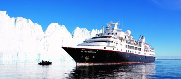
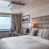
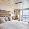
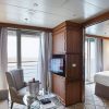
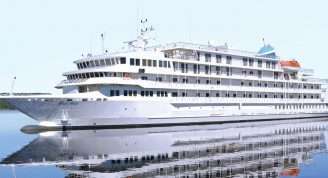
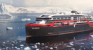
Vessel Type: Luxury Expedition Length: 108 metres Passenger Capacity: 144 Built / refurbished: 1989 / 2008 / 2018 Silversea’s purpose-built luxury Silver Explorer expedition cruise ship has been designed specifically for navigating waters in some of the world’s most remote destinations, including both of earth’s polar regions. A strengthened hull with a Lloyd’s Register ice-class notation (1A) for passenger vessels enables the Silver Explorer Expedition Cruise Ship to safely push through ice floes with ease. A fleet of 12 Zodiac boats allows Silversea Expedition guests to visit even the most off-the-beaten path locations and an expert Expedition Team provides insight and understanding to each unforgettable Silver Explorer luxury cruise adventure.

Itinerary


Day 1 - Day 1 Apra
Guam is blessed with spectacular natural beauty and a rich cultural history. Apra Harbor is a deep-water port located on the western side of the island. The island is part of the Mariana Islands and near the Mariana Trench, which is the deepest part of the earth’s oceans, and the deepest location of the earth itself. The port serves both as a U.S. naval station and Guam’s main commercial port. The harbour, formed by the Orote Peninsula to the south and Cabras Island in the north, is considered to be one of the best natural ports in the Pacific. Guam’s unique culture, traditions and heritage have remained intact despite European imperialism, wars and changing foreign governments. Archaeological evidence suggests that the indigenous Chamorros of Indo-Malayan descent migrated from the Southeast Asian islands and settled throughout the Marianas archipelago. Being expert seamen and skilled craftsmen, they flourished and built unique houses and canoes suited to the region. As a matriarchal society and through the prestige of the women, much of the Chamorro culture and traditions were able to survive. Since the 16th century, a wave of foreigners have arrived on Guam’s shores, including Ferdinand Magellan in 1521 who remained on the island for three days to restock his small convoy. Americans, Asians, Europeans, Micronesians and other visitors have since left their imprint on the island’s pastimes and tastes.
Day 2 - Day 2 Gaferut (Yap)
Gaferut is a rookery island full of nesting birds, and one of the uninhabited islands of the State of Yap in the Federated States of Micronesia. Just 1,500 feet long and 500 feet wide, Gaferut is called Fayo by the Faraulep people of the neighboring atoll some 70 miles to the southwest; meaning stone or rock in the Woleaian language.
Day 3 - Day 3 Lamotrek, Yap
Lamotrek is both a coral atoll in the Federated States of Micronesia, and one of the fourteen outlying atolls that partly makeup the island State of Yap, as well as the only inhabited island of the atoll. While the total land area is less than half a square mile, the atoll’s reef encloses a lagoon that is 12 square miles in size. The population of Lamotrek is approximately 373, and the residents are accustomed to visitors but still maintain their own culture proudly. Visitors to this small island will be greeted with generosity and friendliness that makes up the essence of the Yapese culture. The village is located on the lagoon side of Lamotrek Island and shows almost as many canoe houses as traditional homes. The lagoon offers snorkeling to see giant clams and, if not on a voyage, the Queen Veronica, the biggest outrigger canoe in the whole Federated States of Micronesia, can be seen.
Day 4 - Day 4 Satawal (Yap)
Satawal is a remote coral island made up of just over 1 km2 of land that is thick with coconut and breadfruit trees. It is home to approximately 500 inhabitants. Archaeologists have not yet agreed about when or how the island Satawal was settled. The people of Satawal are culturally and linguistically related to those of Chuuk in the Caroline Islands. Satawal has a narrow fringing reef and is not frequently visited by outsiders. After World War II, the island was controlled by the United States and administered as part of the Trust Territory of the Pacific Islands from 1947. Satawal became an official part of the Federated States of Micronesia in 1979. Satawal is famous for its ocean-going canoes and navigators –Mau Piailug was the navigator on the Hokulea.
Day 5 - Day 5 Pulap
a:0:{}
Day 6 - Day 6 Chuuk Lagoon
Chuuk Lagoon, formerly known as Truk Lagoon, is the main island of Chuuk State –with more than 36,000 residents the largest of the four states making up the Federated States of Micronesia. Located at the center of the Caroline Islands, the reef protecting the lagoon has a length of more than 220 kilometers with 41 islets on it, while 57 islands and islets are found within the lagoon. The capital Weno is on Weno, one of the two larger of several other volcanic islands in the lagoon, hence the local name of Chuuk (mountain). Since none of the islands actually carries the name Chuuk, the lagoon and islands are commonly known as Chuuk Islands. Some 1600 years before the Spaniards first saw and then claimed Chuuk Lagoon, Micronesian had already established themselves on two of the islands. The Caroline Islands were sold to Germany in 1899 as a result of the Spanish-American War and later turned over to Japan as a mandated territory after WWI. The natural harbor created by the reef had been used by the Japanese navy during WWII as its largest forward naval base with submarine repair shops and a communication center. In addition to airstrips and seaplane bases, infrastructure for the more than 44,000 Japanese troops stationed there had been set up. To divers Chuuk Lagoon is one of the highlights in the Pacific because it contains a ghost fleet: during “Operation Hailstorm” 44 Japanese ships were sunk by American carrier-based planes.
Day 7 - Day 7 Oroluk Atoll
a:0:{}
Day 8 - Day 8 Pohnpei
Pohnpei (also known as Ponape) is the largest island in the Eastern Caroline Archipelago and the national capital of the Federated States of Micronesia (FSM). The State of Pohnpei is one of four that comprise the FSM, along with the islands of Chuuk, Kosrae and Yap. Unlike other Micronesian islands, volcanic Pohnpei boasts tropical jungles, mist-covered mountains, mangrove swamps and exotic flora. Abundant rainfall feeds streams, rivers and tumbling waterfalls. Pohnpei’s most prominent landmarks include Sokeh’s Rock, a steep, 800-foot (244-metre) volcanic outcrop overlooking the harbour; the town of Kolonia; and Nan Madol, the mysterious, ancient stone city that is Micronesia’s best known archaeological site and often called the “Venice of the Pacific”. Built on 100 man-made islets by the legendary Saudeleur kings, the ruins can be visited by boat from Kolonia, but require a permit and a guide. The main town of Kolonia boasts such historical sites as the remnants of the Spanish Wall, built in 1889 as a boundary for Fort Alphonso XII; the Catholic Mission Bell Tower, part of the old German church torn down by the Japanese during World War II; the Lidorkini Museum, an occasional Japanese tank, and the Japanese Shrine. When exploring around the island, bird watchers may be able to spot the endemic Pohnpei fantail and Pohnpei flycatcher. Pier Information The ship is scheduled to dock at Dekehtik Port, Pier #4 in Kolonia. The town is within walking distance. Non-metered taxis are available upon call. We recommend establishing the fare before leaving the pier area. Shopping Handicrafts and souvenir items can be found in shops around Kolonia and Kapinga Village. Most shops are open from 9:00 a.m. to 6:00 p.m. The local currency is the U.S. dollar. Cuisine Polynesian and Micronesian dishes as well as the typical American fast food can be found in a variety of eateries and hotel restaurants around Kolonia. Other Sites Explore the island’s capital and see its major points of interest including the Cultural Center. The main attraction is the archaeological site of Nan Madol, reached via a boat trip. For independent sightseeing, it is best to use taxis.
Day 9 - Day 9 At Sea
a:0:{}
Day 10 - Day 10 Nukuor
a:0:{}
Day 11 - Day 11 Kapingamarangi
a:0:{}
Day 12 - Day 12 At Sea
a:0:{}
Day 13 - Day 13 Rabaul
Rabaul, the former provincial capital, has quite a remarkable location. The town is inside the flooded caldera of a giant volcano and several sub-vents are still quite active today! The fumes of the volcano Tavurvur can be seen continually and the town suffered greatly during the last major eruption of 1994 when some 80% of the houses collapsed due to the ash raining down onto their roofs. Rabaul has a Volcano Observatory sitting atop the town’s center, monitoring the 14 active and 23 dormant volcanoes in Papua New Guinea. A small museum opposite the bunker used by Yamamoto during World War II shows exhibits relating to Rabaul’s local, German, Australian and Japanese past from the 19th century to Papua New Guinea’s independence in the 1970s.
Day 14 - Day 14 Jacquinot Bay
Jacquinot Bay is a large open bay on the eastern coast of the island of New Britain. It is a tranquil place with white sandy beaches and tropical palm trees all around. There is also a well-known beautiful waterfall that flows out of the mountainside with freezing cold water right onto the beach. But during WWII, however, it was not a quiet place. It was, in fact, an important base for the Australian Army who liberated it in November 1944. This base was used to support Australian operations near Rabaul which were conducted in early 1945 in conjunction with advances on the northern side of New Britain.
Day 15 - Day 15 Tami Islands
The Tami Islands are a small archipelago of just four islands located south of Finschhafen in the Huon Gulf. Collectively, they are part of Morobe Province. Tami Island is the main island and is one of just two islands in the enclave to be inhabited. The people here are known for their elaborately carved, oblong-shaped “Tami bowls”. The small community of islanders live simply. Tami has just a single primary school and a small medical aid post. Coconut and areca palm trees, Alexandrian laurel and frangipani make for a lush and colourful appearance of the island. South of Kalal Village is a small sandbar that permits snorkelling.
Day 16 - Day 16 Tufi
Tufi is located on the south-eastern peninsula of Cape Nelson in the Oro Province of Papua New Guinea. It is situated on a tropical fjord, which is the work of ancient volcanic activities and was not shaped by ice as the descriptive name might lead you to believe. Surrounded by uncharted coral reefs, the underwater world has attracted many divers wanting to see for themselves how the area earned the description of having more fish than water. Although Tufi has been the administrative centre of the region, traditional ceremonies are still very important with natives wearing tapa cloth made from the bark of mulberry trees found in the local forest. Dance is predominant in the culture and performers sport fanciful headdresses decked with bird-of-paradise plumes and a rainbow of iridescent feathers. Tufi’s wide range of colourful birds and butterflies is well-known throughout Papua New Guinea, boasting several ‘largest’, ‘biggest’ and ‘smallest’ records.
Day 17 - Day 17 Dei Dei Hot Springs (Fergusson Island) & Dobu Island
Fergusson is one of the three biggest and mountainous islands in the Milne Bay Province, and part of the D’Entrecasteaux Islands. On Fergusson’s south side are the famous Dei Dei geysers — natural hot springs that periodically erupt with vapour steam next to mud pools and a warm stream. The hot springs are still used by locals to cook food in palm frond and pandanus leaf baskets placed into the boiling hot water. Birds in the area include Eclectus Parrots, Yellow-bellied Sunbirds and the endemic Curl-crested Manucode – a bird-of-paradise.Dobu is a small island in the D’Entrecasteaux Group next to Fergusson Island and Normanby Island. The island was formerly feared because of black magic and the local “witch” doctors cursing the healthy or treating the sick. An anthropological study was done by Reo Fortune in the 1930s which resulted in the book “The Island of Sorcerers”. The island is also part of the famous Kula ring. Participants in the exchange system pride themselves with mwali and soulava (armbands and necklaces) that are given and received still today and it is interesting to see how the traditional objects have been adorned with modern paraphernalia. A stroll through the main village on the northwestern tip will show the school and church and trails leading along the shore passing traditionally thatched houses and gardens.
Day 18 - Day 18 Samarai
Samarai is a tiny island south of Papua New Guinea’s southeastern peninsula dwarfed by neighbouring islands. Once a famous trading port and the second-largest settlement in the Territory of Papua (the Australian-administered southern part of what today is Papua New Guinea), Samarai used to be Milne Bay Province’s capital until 1968 when administrators were moved to mainland and the town of Alotau. The relocation was necessary as the 29-hectare (72-acre) island was simply overcrowded. With only about 450 residents remaining today, it still is one of the most densely settled islands in Papua New Guinea.
Day 19 - Day 19 At Sea
a:0:{}
Day 20 - Day 20 Cairns
Warmly welcoming you to the natural wonders of the Great Barrier Reef, Cairns is a treasure trove of rich tropical beauty and incredible sea life. Swathes of rainforest spread out to the north, where you can soar over the canopy in a cable car, before looking down over narrow channels of water plummeting down gorges and crocodile-filled waterways. The diverse lands of the Atherton Tableland lie to the west, but it's the crystal-clear waters - and life-filled reefs - of Cairns' remarkable underwater world that draws universal adulation. Priding itself as the Gateway to the Great Barrier Reef, explore Cairns' constellation of colour, as you dive into the world's largest and most spectacular underwater universe. Head out on a glass-bottomed boat tour to explore the 3,000 coral reef systems, and let hours drift by appreciating the waving corals and life-imbued reefs during exceptional scuba diving and snorkelling sessions. Cairns is huddled in amongst abundant swathes of rainforests, which give way to glorious crescents of golden beach. Kuranda - with its scenic railway and heritage market stalls - waits to be discovered, cloaked within the depths of the rainforest. Learn of the indigenous people of North Queensland during cultural performances, and hear the throaty reverberations of digeridoos, as you hear eternal stories handed down through time, from generation to generation. Back in Cairns, there's always time for a coffee or a beer, or a feast on fresh oysters with glasses of Cairns' white wines – boldly flavoured with mango and banana notes.
Day 21 - Please Note:
Itineraries are subject to change.

Trip Dates

StartEndPrice FromRoom Type

Inclusions

    • Discover Micronesia
    • Explore Papua New Guinea

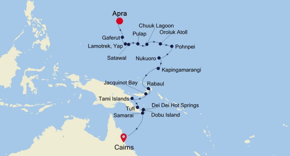
Map